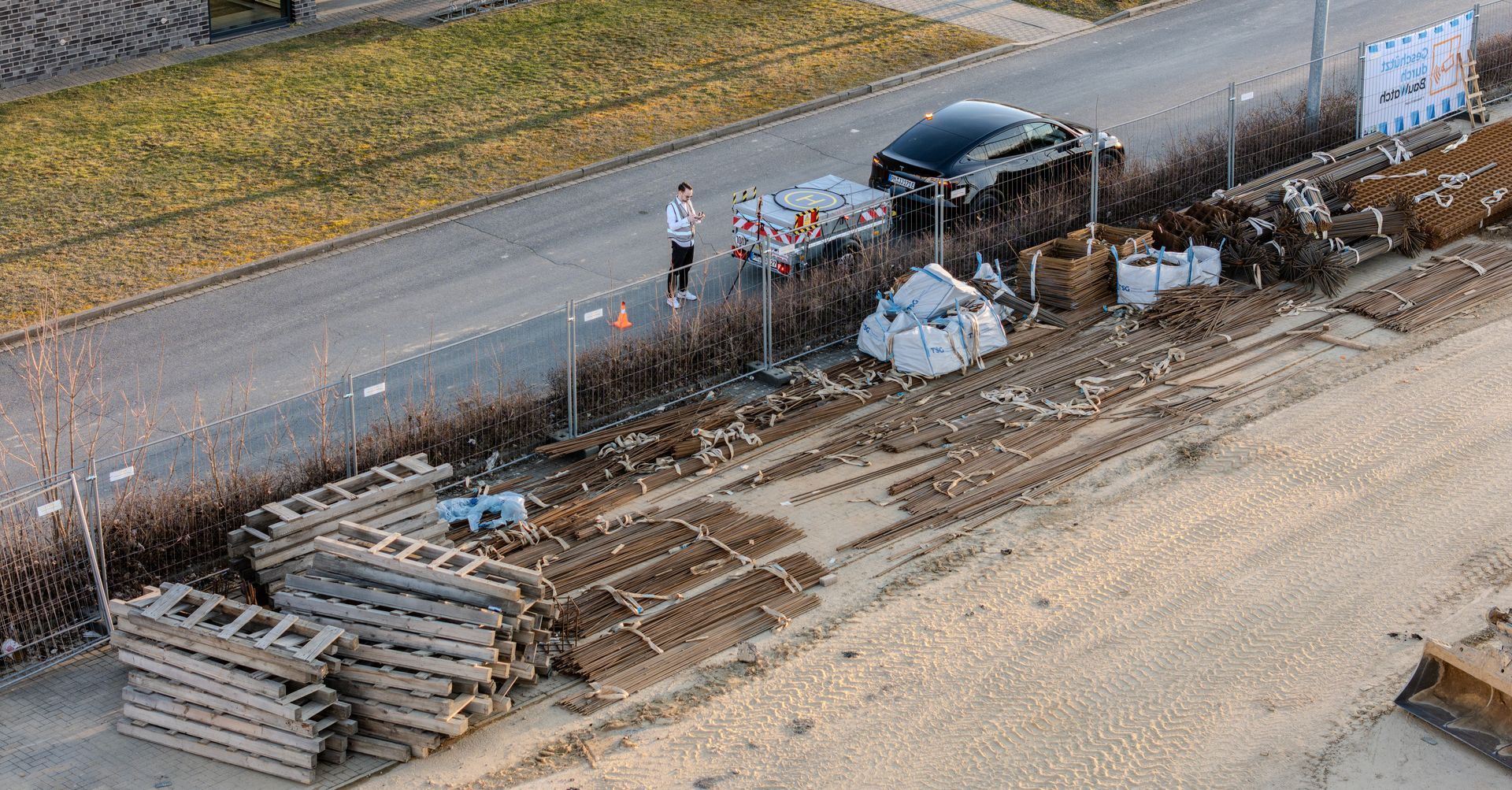
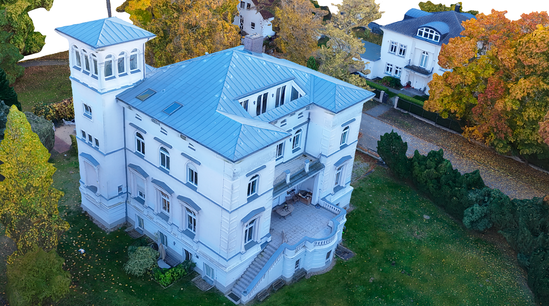
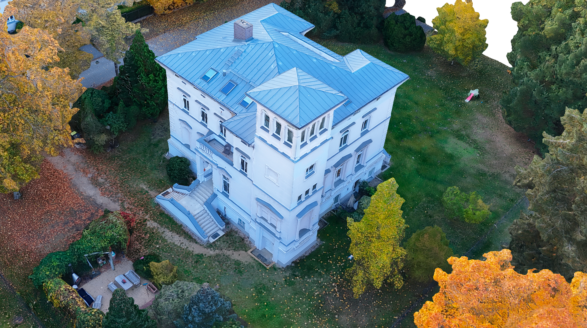
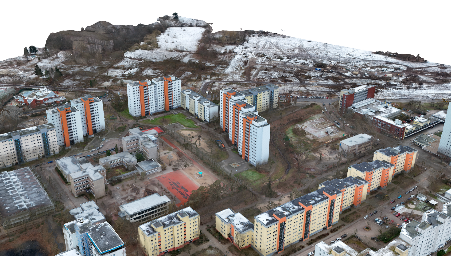
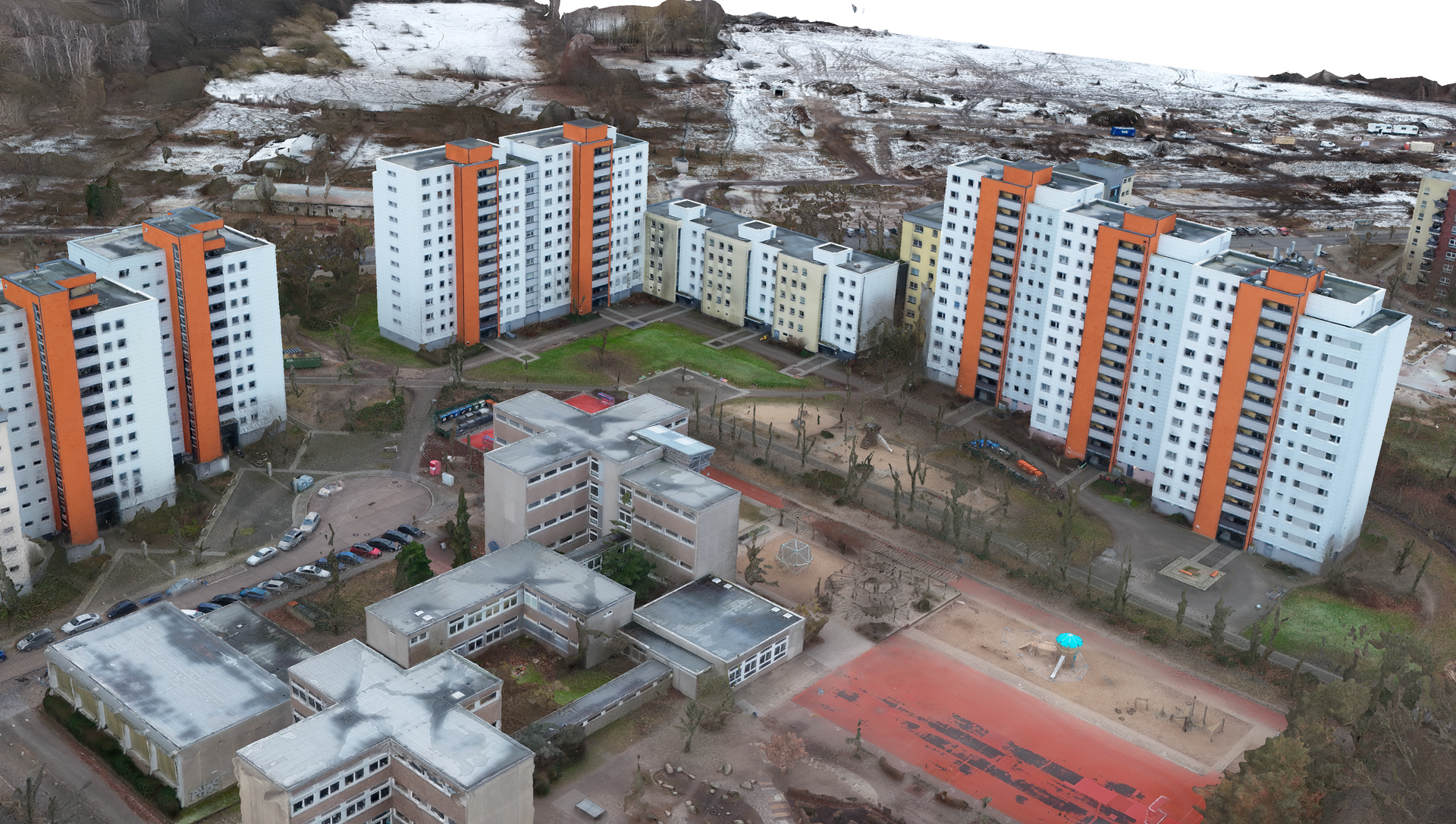
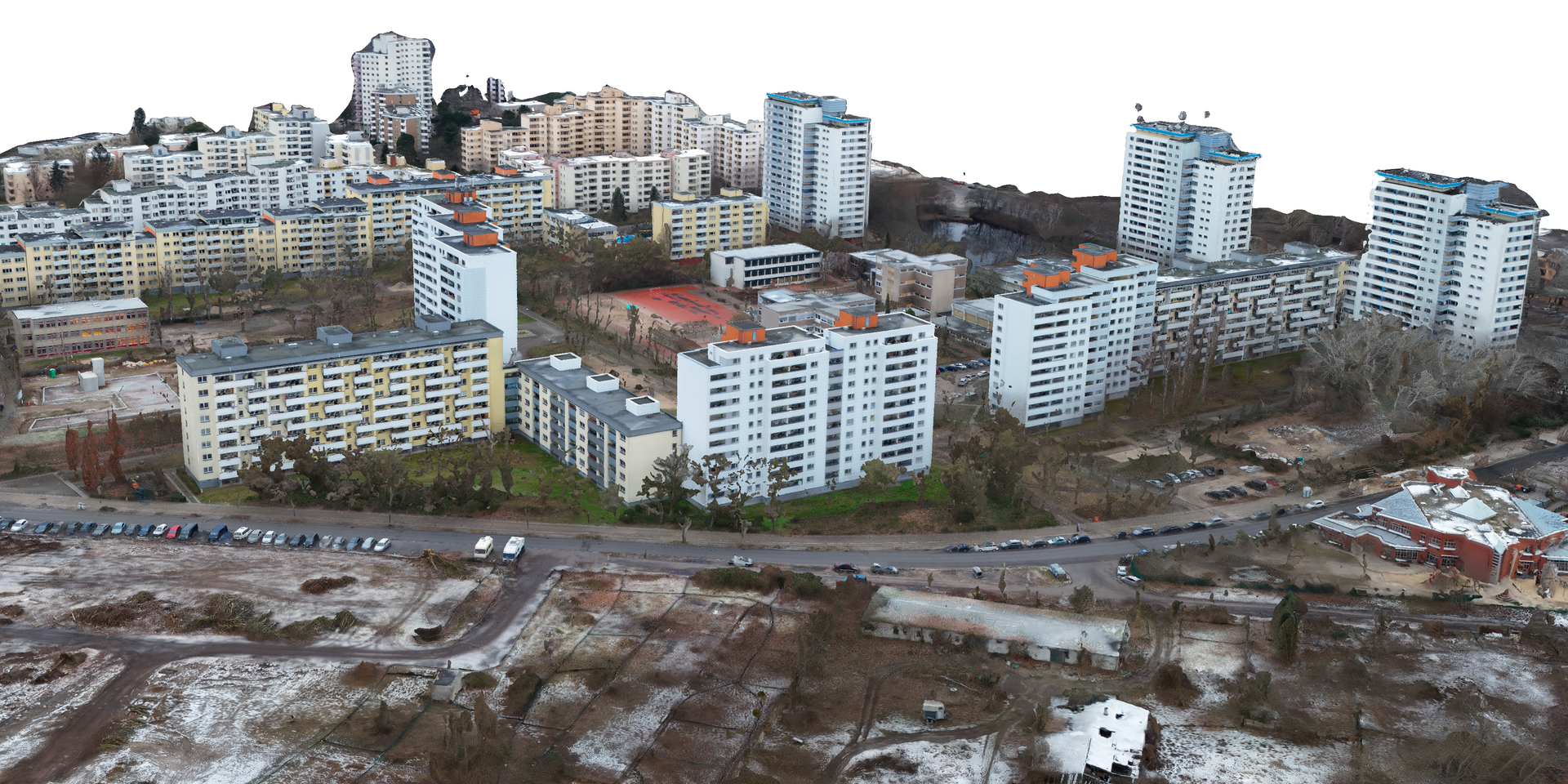
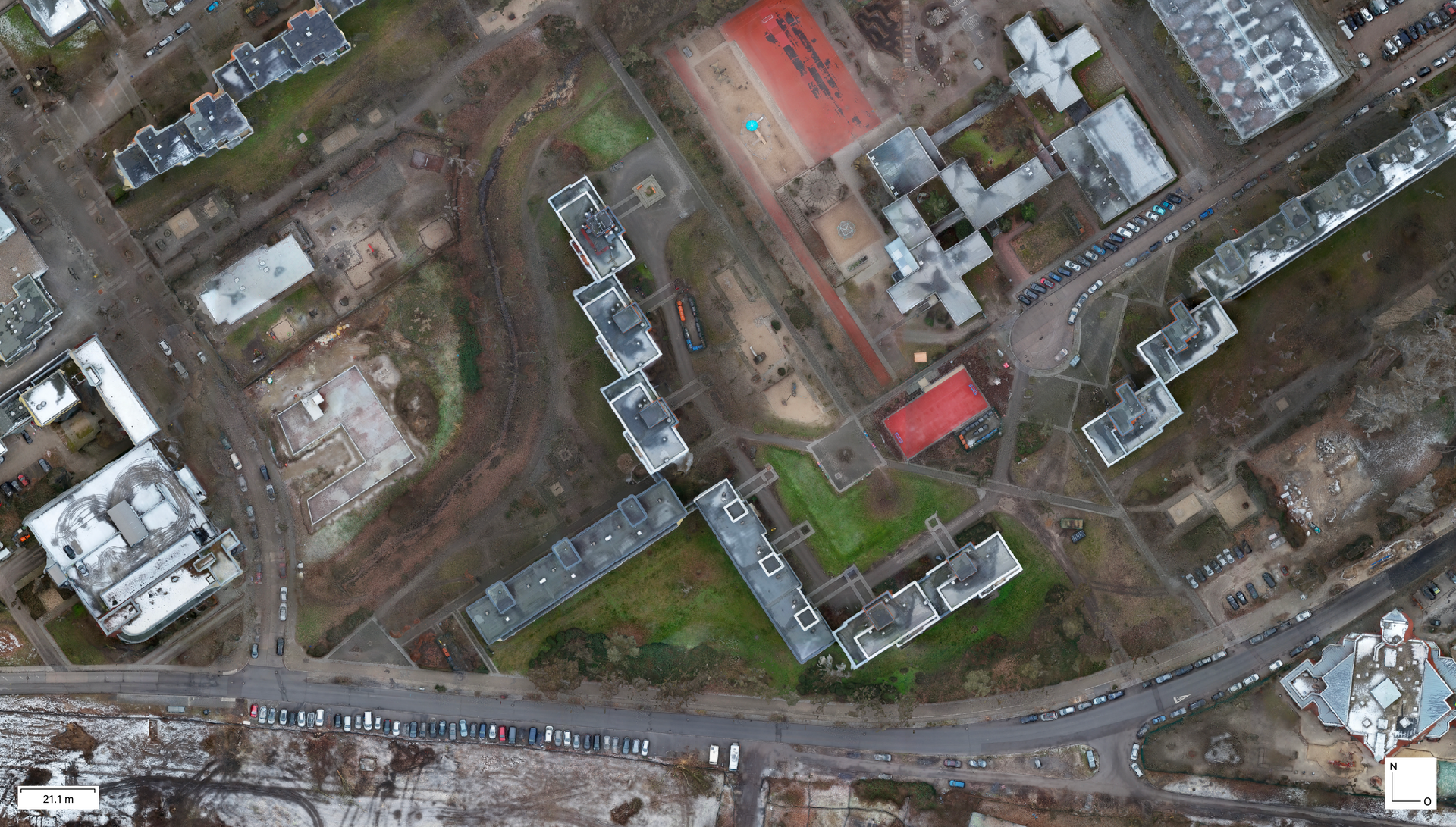
High-precision 3D modeling of your construction projects, buildings and open spaces
Drone-based 3D models enable
detailed visualizations and
Planning and offer your project participants a comprehensive
overviewabout the
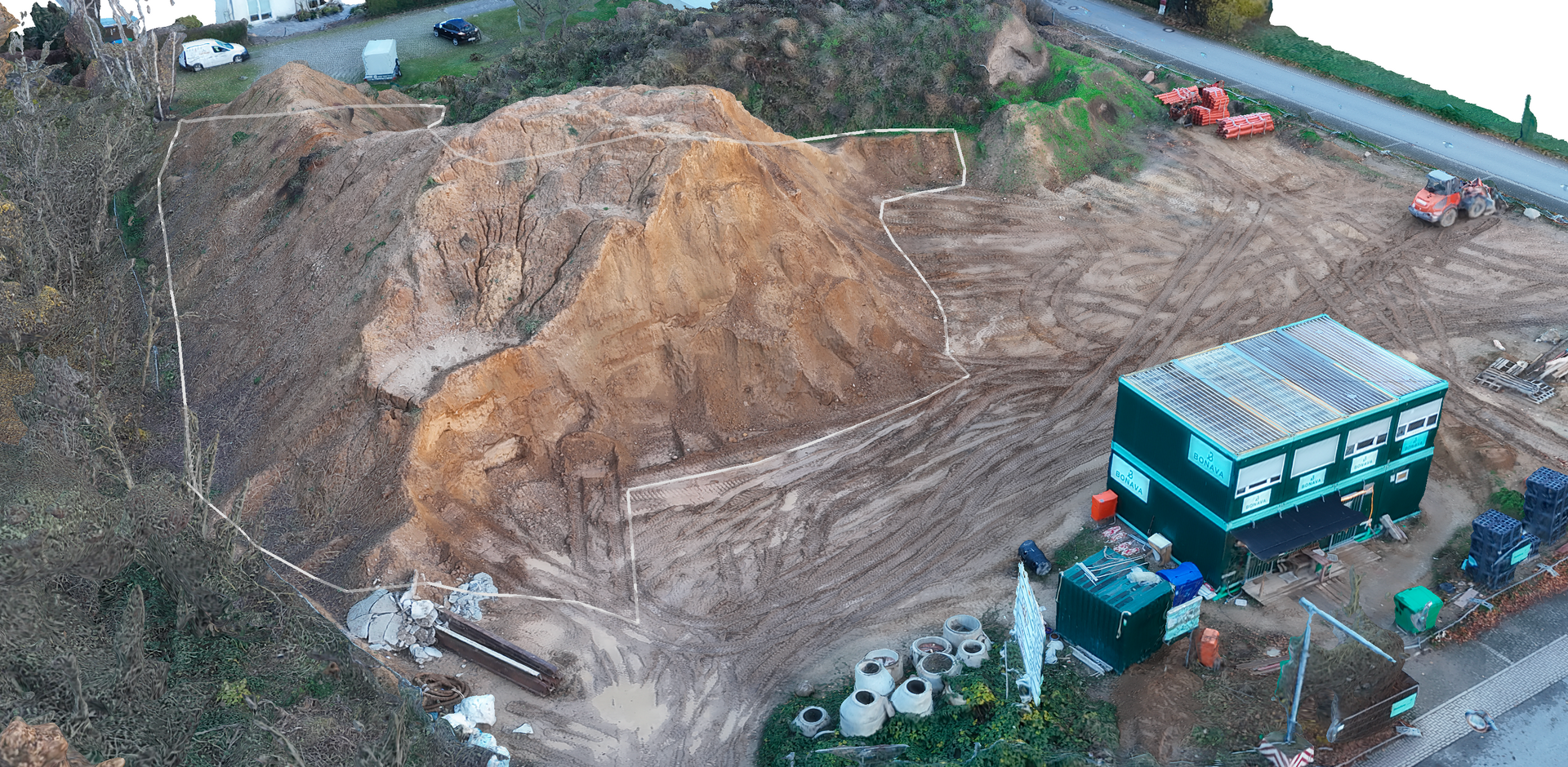
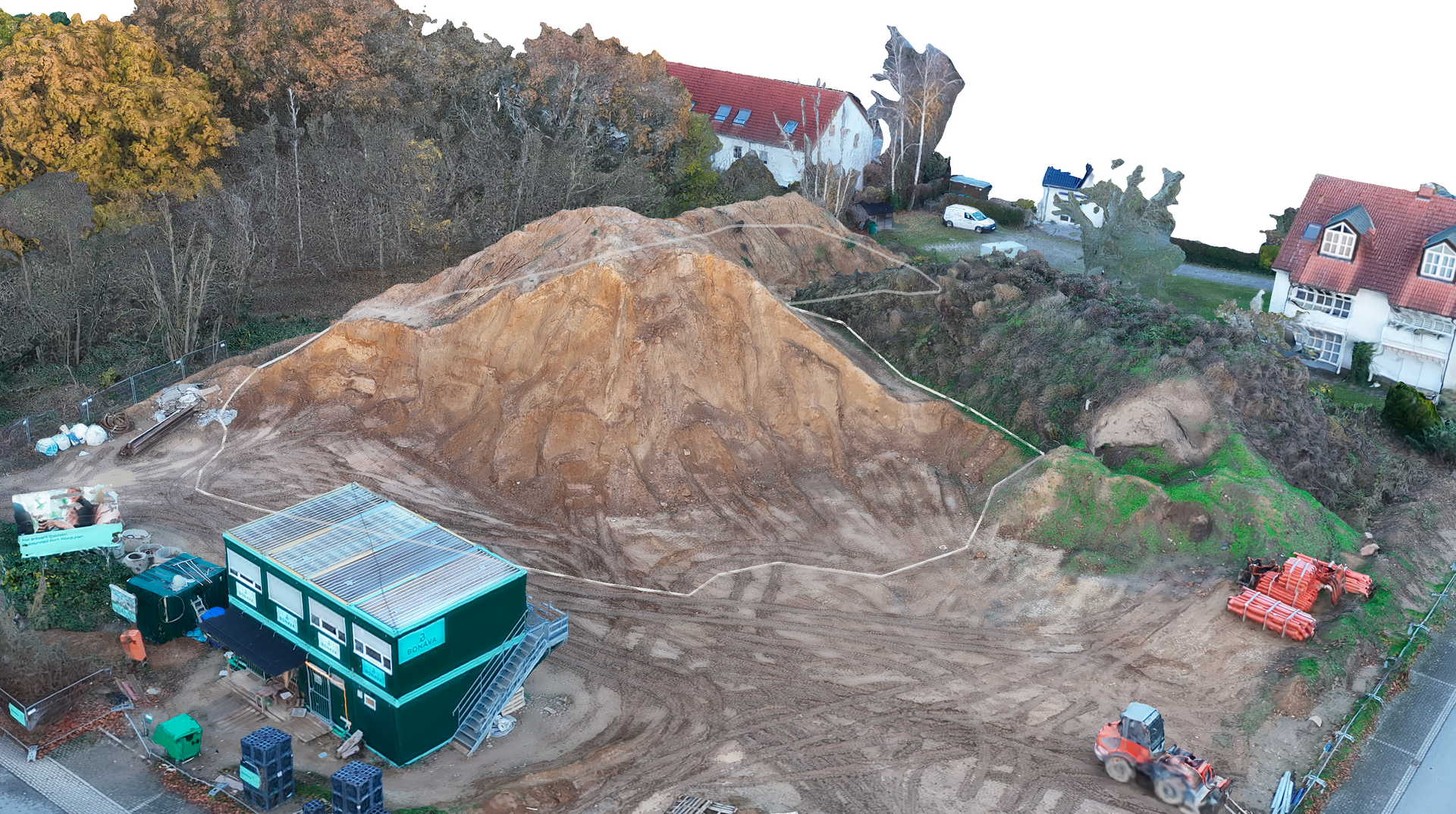
Terrain profile, old stands, earth masses and
existing vegetation
Components of a 3D model:
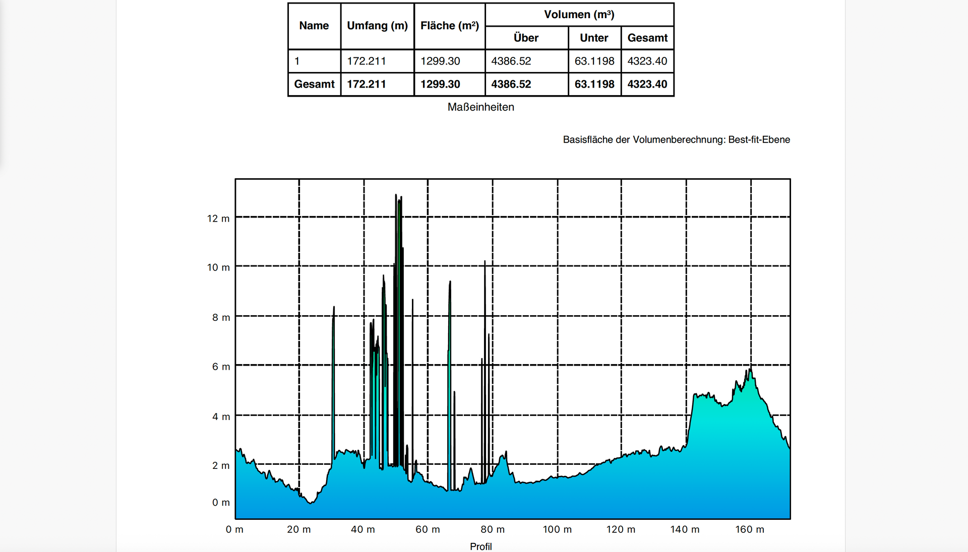
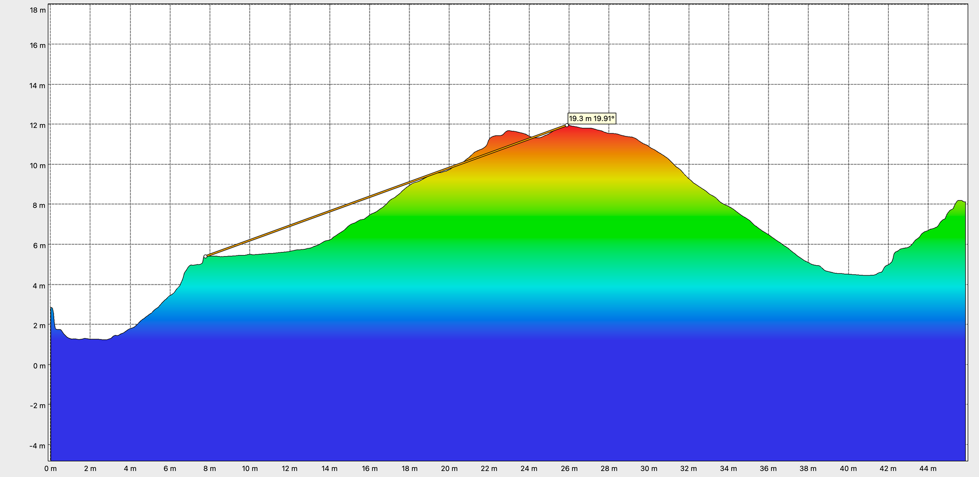
- Dense point clouds: Create high-density point clouds that provide a realistic 3D representation of terrain or objects. This data is ideal for construction planning and structural visualization.
- Digital Elevation Maps (DEM): Creating precise elevation maps for detailed representation of terrain and elevation differences. DEMs are particularly useful for construction planning and topography analysis.
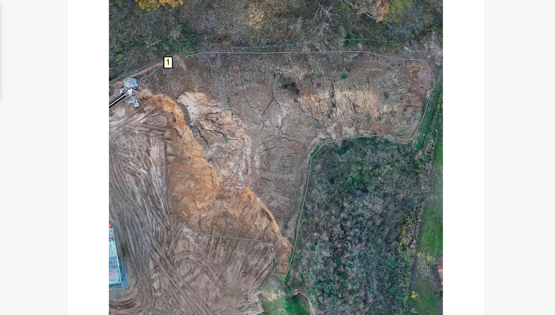
- 3D measurements: Volume and area measurements can be performed directly in the 3D model. This provides an ideal basis for precisely determining the size of the excavated material, buildings to be demolished, etc.
3D model service packages:
LP1: 3D modelling of a total area up to 15,000 m²:
- Creation of a drone-based 3D model
- Measurement of a height profile and volume determination of any polygon
- two high-resolution photos in RAW and JPEG formats (post-edited with Adobe Lightroom/Photoshop)
- a 30-second video in 4K resolution (post-edited with Adobe Lightroom/Premiere Pro)
Flat rate: EUR 1,450.00 (gross)
LP2: 3D modelling of a total area up to 30,000 m²:
- Creation of a drone-based 3D model
- Measurement of two height profiles and volume determination of two arbitrary polygons
- four high-resolution photos in RAW and JPEG formats (post-edited with Adobe Lightroom/Photoshop)
- two 30-second videos in 4K resolution (post-edited with Adobe Lightroom/Premiere Pro)
Flat rate: EUR 2,650.00 (gross)
LP3: 3D modelling of a total area up to 50,000 m²:
- Creation of a drone-based 3D model
- Measurement of four height profiles and volume determination of four arbitrary polygons
- eight high-resolution photos in RAW and JPEG formats (post-edited with Adobe Lightroom/Photoshop)
- two 30-second videos and one 60-second video in 4K resolution (post-edited with Adobe Lightroom/Premiere Pro)
Flat rate: EUR 3,850.00 (gross)
According to Section 19 of the German VAT Act (UStG), the prices quoted do not include any separately stated VAT, as no additional VAT is charged.
A kilometer allowance of
0.70 € per kilometer is charged for all packages.
The starting point is Friggastraße 28 in 14513 Teltow.
The amount of work required is determined by the size of the area to be modeled, regardless of the existing buildings, soil masses, vegetation, etc. In a preliminary discussion, you will inform us of the relevant parcels of land, and we will determine the total size of the area.
Applications and added value of drone use in real estate project development:
Learn more about the benefits of using drones across the entire value chain of real estate project development in a paper about the use of drones in the acquisition, calculation and implementation of construction projects.